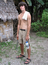
The culmination of almost a year of dreaming and several weeks of planning and scheming was upon me: me and Jammy were about to start the Appalachian Trail. Probably the most common question I got while on the trail was "why are you doing this." This question only has one good answer, "because it's there." This response may sound unsatisfying to most, but it is the god's honest truth, I took on this for basically no other reason than to say that I had and maybe come back with some good stories. I'm happy to report that I was successful on both accounts.
For those heading South, the trail begins at Mt. Katahdin in Maine and ends at Mt. Springer in Georgia. Southbounders (sobos) have something of a front-loaded trip as the hardest parts of the trail are in Maine and New Hampshire, the first 2 states on the south-going route. For this reason, most prefer to head north. One northbounder (nobo) compared it to the slow descent into Mordor followed by the final assault on Mt. Doom. We, however, basically had the sobo route chosen for us due to the convenience of having Jammy's house in Maine. Katahdin is essentially in the middle of Baxter state park, a state park in Maine. After a long night of packing and a crazy early morning start, we arrived around 7am in Baxter. We went to talk to the ranger, who informed us that we really should have called ahead as most of the campsites in the area were booked. He told us that he'd see if he could help us out, but that in the meantime we could get started up Katahdin. The usual route is to take the AT up Katahdin to the summit, and then come back down the same way, camp at the base of the mountain and walk out of the park the next day.
One caveat with going up Katahdin was that we were expecting to enter the 100 mile wilderness right outside of Baxter, and thus needed to be carrying 10 days worth of food as we would be unable to resupply for 100 miles. Thus, our packs were at their heaviest at around 55-60 pounds. For the first couple miles of trail (it's a 5 mile hike to the summit), this wasn't a problem as the trail was not particularly steep. A couple miles in however, we were have to scramble with hands and legs up steep trail sections. The weight was killer. We would generally only be able to stagger a few hundred yards before collapsing on the side of trail for a breather. We made slow progress like this for another mile or so. At this point we started to get worried about our ability to get back down the mountain safely with all this weight. Not convinced of our ability to do so, we turned back. After a lengthy nap at a waterfall on the way down, we rolled back into the ranger's station where we had been that morning. The same ranger greeted us and informed us that he had found a place for us to stay. He then continued: "so yeah, we have these day-packs here for you guys to use, so just grab some food and water and leave your packs here." We stared at him for a few seconds before he realized his mistake. "Oh, OH!" He said, staring at us wide-eyed. He asked us if we'd really made it all the way to the top with our packs on. We told him we hadn't and listened to his profuse apologies before heading to camp. Something of a lackluster start.
The camp we were staying at was reserved for nobo who'd just come through the 100 mile wilderness and were finishing at Katahdin. We were allowed to stay there as only one nobo had come in that day. He looked scrawny and a little under-nourished and all around a little worse for wear. He wander over to talk to us during dinner and we congratulated him on finishing. We asked him how his hike had been. "I hope they pave the trail over," was his response. At this point both me and Jammy were wonder what we'd gotten ourselves into.
The next morning we hiked out of Baxter. The park was very beautiful and the trail ran by a lot of gorgeous rivers, lakes, streams and waterfalls. Katahdin was always visible in the distance. It was a ten mile hike to the park border. At this point in the trip that was still a little long for us, but the terrain was gentle and even though we were carrying a lot we didn't have too much problem. We crossed the last road we would see for 100 miles and plunged into the wilderness. About a hundred feet in an ominous sign warned us that we would not see civilization again for 100 miles and asked if we were adequately previsioned. The thought we were and so we dove right in. We walked a few miles into the forest and stopped to make camp. A few minutes after setting up we discovered the place was crawling with mosquitoes. A heat wave had been stalled over Maine for the past while and the bugs were in full swing. We quickly ate and retreated for the safety of the tent. Even this was not completely bug-safe, as I got a myriad of mosquito bites on my arm through the tent mesh. The next morning we woke up to find the bugs had not abated. We had oatmeal for breakfast, and had what was perhaps the worst experience with oatmeal of our entire lives. It was 9 or so in the morning and already swelteringly hot and humid. We were eating hot oatmeal and dripping with sweat. I felt like I was going to overheat and collapse. I had to keep reminding the flies swarming around that I was not quite dead yet.
Me and Jammy both agreed that we were off to a fairly miserable start and that perhaps we need to reconsider our plan. We decided to call for an evac from Jammy's parents and catch the trail down in Vermont, where the terrain would be easier and resupply would be more frequent, meaning significantly lighter packs. We hiked back to the road and made the call. About an hour later our ride showed up and were piled in. Morale was low, but we still held out hope for an awesome trip when we restarted in Vermont.
Subscribe to:
Post Comments (Atom)
No comments:
Post a Comment